
Long Beach Neighbor Records by Block
The best block-level starting point is a selected address in Nassau County’s map and assessment systems. The map gives the parcel shape, adjacent streets, and useful map layers. The assessment record supplies the SBL and current tax-roll fields for that parcel. A deed index can then confirm a recorded party and instrument. Building records can supply a dated permit or violation trail. These records reveal different, limited facts about a Long Beach block, so do not treat the result as a list of every person nearby.
| Source | What It Shows About a Block | Access |
|---|---|---|
| Nassau GIS | Parcel polygons, streets, historical and flood-context layers, and map relationship | Public map with address Search, Go, Identify, and measurement controls. |
| Nassau Land Records Viewer | SBL, property location, current owner and mailing fields, values, taxes, exemptions, and sales | Address or SBL search; Captcha or account option may appear. |
| Nassau County Clerk | Recorded deed and mortgage parties, legal parcel clues, and recording details | Online route plus public counter, mail, delivery, and drop-box channels. |
| Long Beach WebLink | Potential permit, certificate, or violation timeline by address | Public custom-search route; live field labels were not captured. |
| Library and civic sources | Historical address clues and public organization contacts | Reference, digital collection, public contact pages, or archive appointment. |
A parcel may be a corner, rear, canal, public, or utility lot. Long Beach’s barrier-island shape makes a simple “next door” assumption unreliable. Use the map relationship and the parcel record together. An address search gives a start, but the SBL, meaning Section, Block, and Lot, is the steady bridge to the County Clerk record.
Note: A map parcel identifies land and its public records, not a complete roster of people associated with it.
Map Long Beach Neighboring Parcels
Use the Nassau GIS viewer one parcel at a time. Search the starting address and choose Go. Select the parcel through Identify or by clicking it, then zoom out one or two levels. Click each surrounding parcel separately and open its assessment link. The map’s Layers and Legend controls help distinguish parcel lines from historic-map or flood context. Area, Distance, and Location tools can clarify a canal edge, cross street, frontage, or other relationship that is not clear from a straight line.
- Enter the known Long Beach address in the GIS viewer, then note the selected parcel’s location and SBL.
- Use Identify and a modest zoom-out to click only the adjacent parcels that actually share the block relationship being researched.
- Open the Nassau assessment record for each selected parcel and record the property location, current owner and mailing fields, class, assessed or taxable value, exemption code, and deed book or page when shown.
- Check the County Clerk for recorded instruments and the Building Department for a dated address record. Keep each parcel separate rather than merging a block into one name list.
The GIS parcel layer is polygon-based and its public map is the practical neighbor workflow. It has a published informational accuracy disclaimer, so a legal question belongs with the County Clerk record. For a full named-street record chain, use the Long Beach by-street directory rather than trying to turn a small block search into a street-wide investigation.
Long Beach Parcel Fields for Neighbors
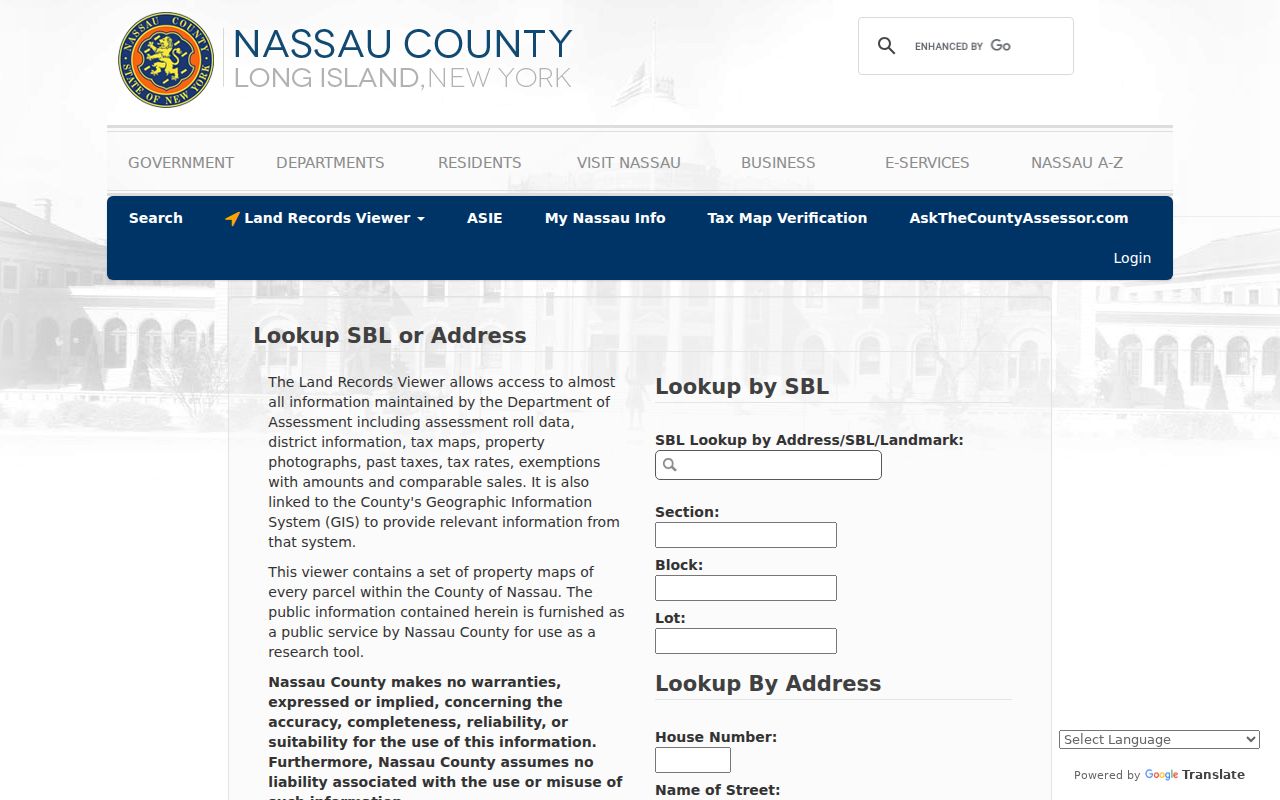
The Land Records Viewer has both SBL and address paths. Its address form uses House Number, Name of Street, Town, and ZIP Code. The county instructions say to leave directional prefixes and street suffixes out of the street field. The related AROW search supports partial street prefixes and has street and ZIP fields. Either route can lead to a parcel card, but neither is a people directory.
The Nassau Land Records Viewer shows the assessment entry that supports the parcel step.
The 2025 Long Beach tentative roll distinguishes PROPERTY LOCATION from CURRENT OWNER’S ADDRESS. It also lists fields such as property class, school district, exemption code, parcel size or grid coordinates, land and taxable values, special districts, and deed book or page clues. That separation is the key insider tip for nearby parcels: a mailing address outside Long Beach can be the place where an owner receives correspondence, not proof of where that owner lives.
- Situs address
- The physical property location used by an assessment or parcel record.
- SBL
- Section, Block, and Lot, the county parcel identifier used to connect assessment, map, and land records.
- Legal description
- The deed’s formal parcel description. It controls more than an informal street label when they conflict.
Long Beach Neighbor Voter Boundaries
New York’s voter lookup is person- and address-driven. It does not promise a map of every voter around a selected parcel. The form includes County, last name, first name, date of birth, ZIP Code, and address inputs, and it may require cookies, JavaScript, or a Captcha. A match can be a limited confirmation for a known registered voter. It cannot establish every person on a block, and it should not be republished as a block roster.
For voter-file data, New York Election Law §3-103(5) requires an elections purpose. The statewide Board of Elections FOIL route calls for requester details, record or district scope, preferred format, and that purpose. Protected voter files are separate, and public voter information does not include ballot choices, signature images, Social Security numbers, or DMV identifiers.
The New York Voter Election Data Archive is also not a neighbor list. It publishes aggregate election data and excludes individual voter records. Use public parcel geography for the block itself and treat voter information as a limited confirmation layer only when its legal conditions are met.
Long Beach Neighborhood Labels
Planning names can help interpret a civic contact or a local-history item, but they do not replace a legal parcel field. The 2023 Long Beach Comprehensive Plan names West End, Westholme, the Walks, Central District, North Park, East End, Canals, and President Streets, with more detailed Westholme and East End subareas. A civic group may use one of those names even when it does not appear in a deed or assessment description.
The city sits on a compact barrier island with the Atlantic and Reynolds Channel shaping blocks and canals. Nearby Atlantic Beach, East Atlantic Beach, Lido, Point Lookout, and Island Park are not interchangeable with Long Beach city. When an address result looks odd, confirm the current street, postal label, municipal boundary, SBL, and map parcel before attaching a neighborhood name to it. Historic records may require the 1911 and 1923 filed maps, Sanborn sheets, or a Clerk Map Room question instead of an invented street-change date.
Note: Use a planning-neighborhood name as context, then confirm the property through its city field and SBL.
Long Beach Civic Groups Are Not Rosters
Public organization pages add a community layer that parcel records cannot supply. The city’s community organizations page lists local cultural, service, school, library, historical, and civic groups. These are public contact and activity routes. The sources reviewed did not locate a public member directory, HOA roll, or block-watch list. Asking about a public program, archived newsletter, photograph, or event listing is different from requesting private membership information.
| Public organization route | Useful block context | Limit |
|---|---|---|
| Long Beach Public Library and its branches | Local-history reference, directories, yearbooks, newspapers, and public programs | Collection access varies; a library card or in-building access may be needed. |
| Long Beach Historical Society | Maps, photographs, city guides, organizational material, and late-1800s-to-present local history | Research is by appointment; it is not a current-person roster. |
| Chamber, Latino Civic Association, Lions, Kiwanis, and arts groups | Public event, organization, or business-history context | The city page lists contacts, not private member files. |
| West End Neighbors and related civic activity | Public-program context, including Movies on the Beach beginning in 2012 | A civic connection does not prove that a person lives on a particular block. |
The Long Beach Historical Society was founded in 1980 and holds thousands of pieces of local history. It is an appointment-based route for older maps, city-management material, photographs, ephemera, and public organization history. For older people-and-address clues, the Long Beach Public Library city directories, yearbooks, newspapers, digital archive, and History Index remain the more appropriate search path.
Long Beach Neighbor Source Checks
Keep the source closest to the record at the center of a block search. A commercial neighbor tool may combine property, court, marketing, and other data, but it can join similar names, lag behind a move, omit protected people, or display an association that the original custodian would not confirm. The original GIS, assessment, Clerk, Building Department, library, and court source each has a clearer scope and a route to ask about an error.
| Official record path | Commercial neighbor category | Best use |
|---|---|---|
| GIS, assessment roll, deed index, permit record, or library collection | Combined profiles assembled from many datasets | Use the official source to verify the specific property, record date, or public role. |
| Custodian office or archive staff | Summary that may not identify its original source clearly | Ask the office or archive about a documented gap, correction, or access channel. |
For a deed, start with the online Nassau County Clerk route and move to Room B-1, mail, delivery, the lobby drop box, or counter service when needed. For an address permit or violations question, use the WebLink route first, then ask the Building Department for an address search or a FOIL request that names the address, approximate years, and record type. The city code’s central violations file is an address-history lead, not a list of people.
Long Beach Neighbor Lookup Limits
Some details about a block should remain private. A public parcel can show a current owner or mailing field, but it does not identify every household member. Utility and delivery records are not public resident records. Protected voter information, Address Confidentiality Program locations, sealed or restricted court files, and restricted vital records are also outside a normal neighbor search. An absent result may be protected, outside the source’s scope, or simply not digitized.
New York’s Address Confidentiality Program supplies a substitute address and protects an eligible participant’s actual location. The confidential-voter process is separate and keeps accepted records unavailable to the public except election officials. Respect those limits, and avoid publishing a full date of birth, signature, Social Security number, driver-license number, or protected address from any source.
Lawful use. Use Long Beach neighbor records for personal, lawful research, public-source verification, and civic context. Never use any result to stalk, harass, intimidate, or harm another person.