
Search a Long Beach Street
Use one known house number before widening the search. Nassau County’s address tools are built to locate a parcel, not to return a complete list of people on a roadway. The useful result is a chain of identifiers: the situs, or physical property address; the Section, Block, and Lot; the current owner and mailing field; and any deed book or page information shown on the roll. Those details let a reader test records from different custodians without assuming that a tax notice address proves where someone is present.
- Enter the house number, street name, Long Beach, and ZIP in the Nassau Land Records Viewer. Leave directional words and street-type suffixes out of the street field.
- Record the parcel’s SBL, situs address, current owner field, mailing field, and deed reference. An SBL is Nassau’s Section, Block, and Lot identifier.
- Open the same location in the GIS viewer. Click the parcel and inspect nearby parcel lines, cross streets, and available historic map layers.
- Use the SBL, recorded parties, and deed reference in the County Clerk’s land-record route. If the web route does not expose the needed item, use the public counter, Map Room, mail, delivery, drop-box, or e-recording route.
- For an earlier year, compare a reverse directory entry with the alphabetical entry and preserve the edition year and page. A known person can then be checked through the limited voter confirmation route where lawful.
The order matters. It anchors the Long Beach street directory in a parcel before a name is carried into another index. A parcel owner, a deed party, a permit applicant, and a registered voter can be different people with different connections to the address.
Long Beach Street Directory Fields
The Nassau County Land Records Viewer is the practical start for a current Long Beach street directory search. It combines assessment data, tax maps, property photographs, tax information, exemptions, comparable sales, and parcel links. Search by address, SBL, GeoSearch, or map. The related AROW assessment-review form also accepts partial street prefixes, so a beginning such as “Ches” can return several street names. Both systems should be read as parcel tools, not as a promise of a full-street roster.
The public screen captured from the Land Records Viewer shows the address and SBL paths used to begin a Long Beach street directory search.
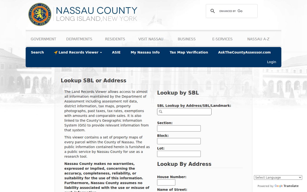
Use the parcel detail after the initial match, then reconcile its SBL with the County Clerk record because the assessor and Clerk formats can differ.
| Viewer field | Entry | How it narrows a street search |
|---|---|---|
| House Number | Property number | Starts with a specific situs address. |
| Name of Street | Street only | Omit directional and suffix words; a partial prefix may help in AROW. |
| Town | Long Beach where offered | Separates the municipal search from similarly named Nassau places. |
| ZIP Code | Five-digit postal field | Further narrows an address route; AROW displays it as required. |
| Section / Block / Lot | Three parcel fields | Provides the bridge from map and tax roll to a land record. |
Captcha controls can appear on the viewer. It also offers an account option to bypass the Captcha. Do not work around a challenge; use the normal public interface or an office channel.
Walk Long Beach Parcels
The Nassau GIS map viewer is the map companion to the assessment result. Search by address, select Go, and use Identify or a parcel click to open the record path. Legend, Layers, and Tools help place a parcel among street lines and local geography. The map includes Nassau historical layers for 1926 and 1950, New York State layers for selected later years, and FEMA flood-zone information. Measurement controls can report area, distance, or a location.
A map is especially useful on the barrier island. A corner, rear, canal, public, or utility parcel may look adjacent yet carry a different street number or postal label. The polygon boundary is better evidence of the relationship than a quick visual guess. The GIS service is informational, so a legal boundary or ownership question still belongs with the County Clerk’s recorded material.
- Parcel
- A mapped piece of land represented by an SBL and assessment record.
- Situs address
- The physical location of the property, which can differ from a mailing address.
- Plat or filed map
- A recorded map that helps connect a subdivision or lot layout to a legal description.
- Criss-cross directory
- A historical directory arranged by address so a reader can look from a number to a listed name.
Long Beach Street Records Compared
A street directory is stronger when it distinguishes the record’s purpose. The City of Long Beach Assessor maintains municipal valuation, tax-roll, and exemption information. Nassau LRV adds the parcel interface. The County Clerk holds the land instruments, and the Building Department can supply a dated address trail. The state voter lookup is a narrower confirmation tool. It asks about a known voter and does not create an open list of everyone who may be associated with a street.
| Address-keyed source | What it can show | Long Beach access route |
|---|---|---|
| Assessment roll and LRV | Parcel, situs, current owner and mailing fields, values, exemptions, taxes, sales, and deed reference. | Online LRV; City Assessor for municipal roll questions. |
| Nassau GIS | Parcel polygons, street context, map layers, and measurement. | Public online map viewer. |
| County Clerk land records | Deeds, mortgages, assignments, satisfactions, grantor and grantee history. | US Land Records, Room B-1, Map Room, mail, delivery, drop box, counter, or e-recording. |
| Building and code records | Permits, certificates of occupancy, notices, orders, and possible correction status. | WebLink custom search, Building Department assistance, or a focused FOIL request. |
| Voter confirmation | A registered-voter match and related registration information for a known person. | State voter lookup; voter-file requests require an elections purpose. |
The records do not merge automatically. Save the tax-roll year, the full property location, the owner mailing field, the SBL, and the source date. That small audit trail makes it much easier to spot a stale address, a same-name person, or a parcel that does not match the recorded instrument.
Note: A mailing field shows where a tax notice goes and does not establish present residence at the Long Beach property.
Long Beach Deeds by Address
The Nassau County Clerk land-records page connects to US Land Records and the Land Recording Guide. The web route is useful, but its complete field list, historic cutoff, result cap, and image pricing were not stated on the official public pages reviewed. That limitation is important. Older land work may require a public terminal or an office request instead of an online result.
The screenshot from the Nassau US Land Records search represents the online entry point for deed-index work.
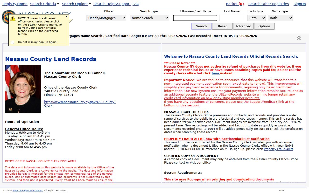
When an address result supplies an SBL or deed reference, use it as a finding aid rather than relying on a street name alone. The recorded document carries the legal description and party roles.
Start with the latest recorded deed available for the parcel. The buyer is the grantee and the seller is the grantor. Search a seller as a prior grantee to move back one transaction, and repeat while comparing the SBL and legal description. The County Clerk’s Map Room maintains maps for Nassau sections, blocks, and lots, including condominium, cooperative, and wetlands maps. Certified deed copies can be requested in person or by mail with an SBL; the published charge is $10, including a $5 search fee.
Long Beach Permits by Address
The Long Beach Building Department adds dates and work descriptions to a property record. Its responsibilities include permits, certificates of occupancy, inspections, construction, electrical, plumbing, sanitation, and zoning matters. The city directs readers to a WebLink permit custom search, although the live field labels were not captured in the research. Search the route normally, then ask department staff for an address search when an older file or field is not indexed.
A permit can identify an applicant, owner, contractor, architect, work type, date, and status when those details appear in the document. Treat each label carefully. A person named on a project does not become a resident merely because the record is tied to the address. The city’s central violations file can also combine notices or orders from building, fire, health, and other agencies and note clearance, correction, or abatement. It is an address-history clue, not a household list.
Long Beach Historical Street Names
Older Long Beach address research needs a map check. The city code references a Map of Estates of Long Beach filed with the Nassau County Clerk in 1911 and a West End map filed in 1923. The verified Sanborn volume is dated 1922, republished in 1955, and has 36 sheets. Those materials can connect a modern parcel to an early subdivision or reveal a street arrangement that a current map no longer makes obvious.
No verified citywide renumbering or renaming year was located. Do not invent one when a number fails to match. Compare the current SBL, cross street, historic map, deed legal description, postal city, and the directory year. The city-directory collections cover approximate years from the late 1890s or early 1900s through the 1960s, with exact gaps and publishers still needing confirmation. For a deeper historical shelf, the Long Beach city directories provide the collection-focused route.
Long Beach Voter Search Limits
The New York voter registration lookup accepts county, last name, first name, date of birth, ZIP, and address inputs for a known registered voter. It is a person-level confirmation tool, not a searchable Long Beach street directory. A result can help distinguish two people with similar names, but it does not prove that every person at an address appears in the public result.
New York Election Law §3-103(5) requires an elections purpose for voter-registration data requests. Protected voter records are separate from ordinary public access, and ballot choices, signatures, Social Security numbers, and DMV identifiers are not part of this street research. A nonmatch can reflect a move, an update, a cancelled or inactive record, or a protected record. It cannot establish that an address has no occupants.
Long Beach Parcel Mailing Clue
Insider tip. The 2025 Long Beach tentative tax roll separates PROPERTY LOCATION from CURRENT OWNER’S ADDRESS. It also lists tax-map parcel ID, property class, exemption code, school district, land and taxable value, parcel size or grid information, special districts, and deed book or page details. The public PDF spans 1,818 pages. Its two-address layout is useful because it explains why a tax notice can go to another Nassau community even when the parcel itself is in Long Beach.
Use that second address as a contact or record-location clue only. It can be outside the city, and it does not prove where an owner is now living. The more stable link is the SBL, which appears in the assessment system and on the first page of a Nassau land document. The deed and filed map control the legal parcel description.
Long Beach Street Directory Limits
Even a careful Long Beach street directory search cannot reveal every person connected with an address. Public records may identify a parcel owner, a recorded party, an address in an older directory, or a registered-voter match, but they do not amount to a complete household roster. Utility customer lists are not public resident records. Federal Driver’s Privacy Protection Act rules also restrict DMV personal information, so a driver-address lookup is not part of this process.
New York’s Address Confidentiality Program and confidential-voter process protect eligible people’s actual locations. Sealed court material and relationship-limited vital records have their own restrictions. When a published record conflicts with a protected or unavailable record, respect the limit and ask the custodian about the proper access route rather than trying to piece around it.
Lawful use. Long Beach address records support personal, civic, archival, and family-history research. Never use a record trail to stalk, harass, intimidate, or harm another person.