
Long Beach ZIP Coverage
Official material verified one standard ZIP code for Long Beach city: 11561. It is the postal starting point for city address research, but its label is not a municipal boundary line. USPS describes a Long Beach location as 11561-3561, while the city’s tax-roll and parcel systems use property and municipal fields for their own purposes. No additional standard city ZIP, unique ZIP, split ZIP, or PO-box-only ZIP was located in the official sources reviewed.
| ZIP | Areas covered | Post office / verification | Research note |
|---|---|---|---|
| 11561 | Long Beach city proper in official city and tax-roll material | USPS Long Beach location and address-level ZIP lookup | The only standard city ZIP verified; postal territory can extend beyond municipal limits. |
The official USPS ZIP Code Lookup is the final check for a street address. The page screen below is from that postal lookup route.
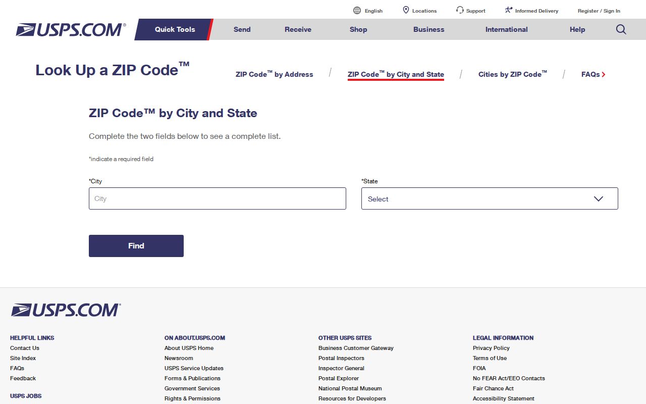
Use the returned ZIP with the complete address rather than treating a city name alone as proof of municipal coverage.
Long Beach ZIP 11561
11561 is the verified Long Beach postal code, yet it is only one layer of location information. A ZIP is assigned for postal delivery. It is not a legal parcel description and it does not establish the city limits for a property. Nearby barrier-island labels can make that distinction matter. Atlantic Beach, East Atlantic Beach, Lido, Point Lookout, and Island Park are distinct places in map or postal usage and should not be silently counted as Long Beach city.
The research did not establish exact USPS coverage of every nearby mailing label. When a result sits near a city edge, keep the postal city wording from USPS, then check the Long Beach city or town field, the Nassau GIS parcel, and the SBL. Point Lookout is a nearby distinct place, not an interchangeable Long Beach result. This cautious order avoids turning a broad postal label into a municipal conclusion.
Find Long Beach Records by ZIP
Use a postal code to narrow a known address, not to generate a citywide people list. The Nassau assessment interface accepts ZIP as part of its address search. The GIS viewer then supplies parcel geography. The New York voter lookup accepts ZIP as one of several inputs for a known registered voter. The citywide 2025 tentative tax roll can be searched as a document, but it is not organized as a ZIP-based export.
- Verify the complete street address through the USPS lookup and record the returned postal city and ZIP.
- Enter 11561 with a house number and street in Nassau LRV, then select Long Beach when the town field offers it.
- Open the matched parcel in the Nassau GIS map and record the Section, Block, and Lot from the parcel or tax roll.
- Use the voter lookup only when a person’s name and other confirmation fields are already known. It is not a ZIP-wide roster.
- For permits, certificates, tax questions, or a recorded instrument, take the address and SBL to the appropriate city or county custodian.
Once the ZIP has narrowed the address, the Long Beach street directory explains the parcel, GIS, and deed sequence in more detail. The postal search then stays focused on geography rather than rebuilding that address-by-address trail.
Long Beach ZIP Search Fields
The Nassau Land Records Viewer lets a user search by address, SBL, GeoSearch, or map. Its address form displays House Number, Name of Street, Town, and a ZIP field. The related AROW assessment-review form displays House Number, Street, City Postal Name, a ZIP field, and Section, Block, and Lot alternatives. On AROW, Street and the ZIP field are shown as required. For LRV street entries, omit directional prefixes and street-type suffixes.
| Search field | Displayed use | ZIP directory caution |
|---|---|---|
| House Number | Locates a situs number | Use with the full street, not as a ZIP-only query. |
| Name of Street | Street text in LRV or AROW | Omit directional and suffix words; a partial prefix can work in AROW. |
| Town / City Postal Name | Municipal selection or postal label | Do not treat these two labels as automatically identical. |
| ZIP Code | Five-digit postal field | 11561 narrows the address route; it is not a whole-ZIP owner export. |
| Section / Block / Lot | Parcel alternative | More precise than ZIP when a legal parcel must be confirmed. |
LRV also has Search, Clear, map-search, and Captcha controls, plus an account option to bypass the Captcha. A captcha should be handled through the normal public interface. The result can show assessment and parcel information, but it does not promise a user-friendly export of every owner in a ZIP.
Long Beach ZIP Boundaries
A postal city label and a city boundary are different systems. A Long Beach mailing address can be used for a nearby barrier-island place, while the mailing field for a Long Beach parcel’s owner can identify another Nassau community. The 2025 tax roll separates PROPERTY LOCATION from CURRENT OWNER’S ADDRESS. The SBL and deed legal description are separate again. When those layers disagree, verify the complete USPS address, city or town field, SBL, GIS parcel, and municipal map before relying on a result.
- ZIP versus ZIP+4
- The five-digit ZIP identifies a delivery area; the added four digits narrow delivery sorting for a more specific address range.
- PO-box ZIP
- A ZIP used for post-office boxes rather than a standard street-delivery area.
- Unique ZIP
- A ZIP assigned to one organization or destination rather than the usual geographic delivery area.
- Carrier route
- A postal delivery sequence within a ZIP; it is not a municipal district or a parcel boundary.
Boundary check. A ZIP match can narrow a postal search, but the SBL and recorded parcel remain the stronger bridge to Long Beach city and Nassau County records.
Long Beach ZIP Voter Context
The New York voter registration lookup includes a ZIP field among its inputs, along with county, last name, first name, date of birth, and address fields. A browser may also present cookie or Captcha controls. It is intended to locate a known registered voter, not to identify all residents of 11561. Use Nassau County as the county field and a full, confirmed person record when a lawful verification is needed.
New York Election Law §3-103(5) requires an elections purpose for voter-registration data requests. Public-list rules do not make protected voter records or sensitive identifiers available. A voter nonmatch could reflect a move, a changed record, an inactive or cancelled status, or confidentiality protection. It must not be treated as proof that someone has never been associated with a Long Beach address.
Note: VEDA publishes aggregate election information, not individual voter records, so it cannot answer who lives at a ZIP or street address.
Long Beach ZIP Registry Search
The New York State DCJS Sex Offender Registry includes ZIP as one of three search choices, along with Last Name and County. The form permits one chosen field, offers boxes to exclude certain custody categories, and displays a Captcha, Search, and Clear controls. Its public online results cover Level 2 and Level 3 registrants, subject to the registry’s disclaimer. A ZIP result is an official registry search result, not a general resident directory.
The capture from the DCJS registry search shows the official search interface that includes the ZIP option.
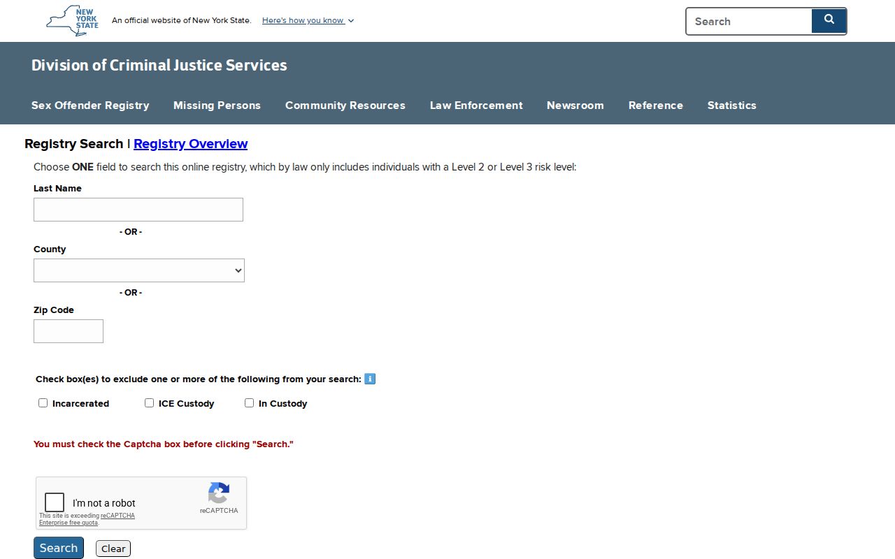
Use the registry only under its lawful purpose and disclaimer. Do not infer guilt, current presence, or identity from an address match alone. Level 1 and undetermined-risk information have a different phone process that requires an individual’s identifying details.
Long Beach SBL Beats ZIP
A postal ZIP is helpful for delivery and search narrowing, but Nassau Section, Block, and Lot is the more stable record connector. The SBL appears in LRV, the tax roll, and County Clerk land documents. It links a current parcel search with a deed book or page, a filed map, and a legal description. The SBL itself is a locator, not the complete legal description, so recorded deeds and filed maps remain controlling evidence for the parcel.
The County Clerk Map Room maintains Nassau maps for sections, blocks, and lots, including condominium, cooperative, and wetlands maps. The Nassau GIS viewer supplies the map context, while the Clerk’s land record route supplies recorded instruments. That three-part check is more reliable than trying to make a postal label serve as an ownership or boundary record.
Long Beach ZIP Neighborhood Context
Long Beach’s 2023 Comprehensive Plan identifies West End, Westholme, the Walks, Central District, North Park, East End, Canals, and President Streets. Those names are useful clues in a postal-area search because a local source may use a neighborhood label rather than a formal parcel description. They are not replacements for the legal city name, address, SBL, or deed description. The plan also uses more detailed Westholme and East End subareas.
Those planning areas work best as a cross-check after the address has been verified. A neighborhood label can help explain a newspaper or directory entry, but it should never replace the USPS result or the official parcel field when a record is being matched.
Myth. A compact city with one verified ZIP is not one undifferentiated record area. The city had 35,029 people in the 2020 Census across 2.22 square miles, so same-name and household distinctions still matter. Those citywide figures do not describe a ZIP or a block. Preserve the source date and label for each result, especially when a historic directory, 1922 Sanborn map, 1925 census, and current tax roll use different geographic language.